Research report
Fieldwork — visual localization research
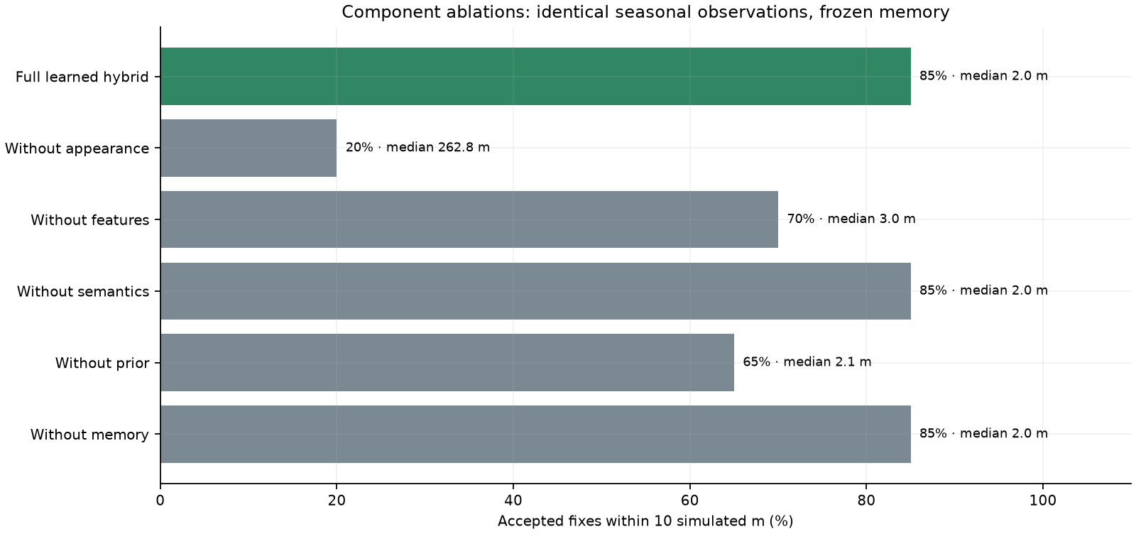
Where is the vehicle, given only what its camera sees? Reference and live images are independent renders of the same latent terrain; four matching algorithms, geographic-structure extraction, candidate-evidence inspection, protected observation memory, learning replay and ablations are evaluated under a fixed protocol. Truth is held by the evaluator only. Open the live sandbox →
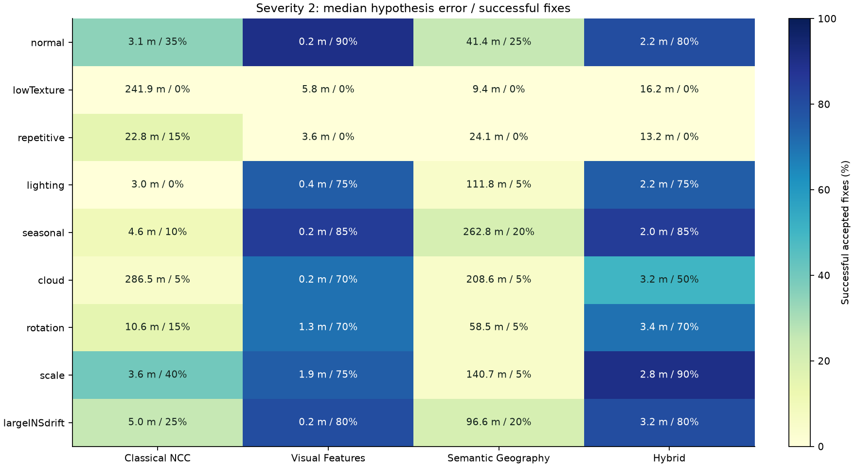
27scenario cases (9 scenes × 3 severities)
2,300evaluation records
4algorithms: NCC · local features · semantic · hybrid
33 / 33automated tests + browser validation
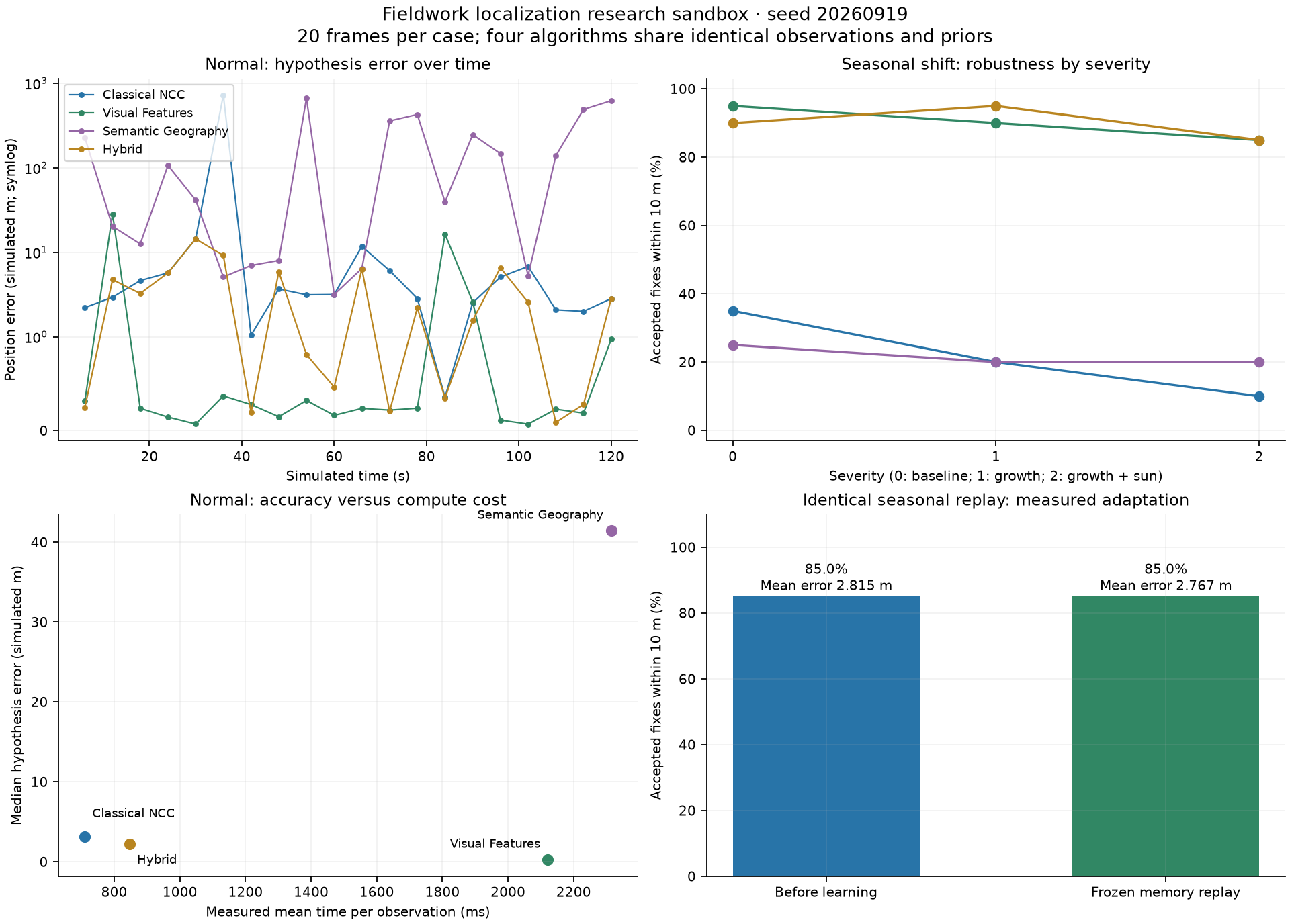
2.815 → 2.767 mmean error after learning replay
17 / 20accepted fixes (85 %), unchanged by learning
Reports
Architecture, algorithms and methodologyInformation boundaries, geographic representation, the four localizers, learning protection, protocol, computed vs illustrativeV4 benchmark resultsFindings, severity-2 comparison, learning and counterfactual ablations, calibration and limitsExperiment 02 — Learning the LandscapeLearned geometry, information gain, when information reduction misleadsExperiment 02 — fixed protocolQuestions set before measuring, controls, freeze and reproducibility
Figures